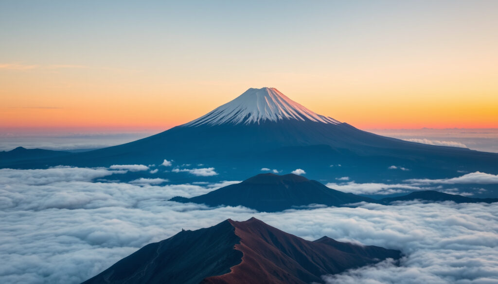
Mount Fuji: Climbing, Height, Location, and Eruption Facts
You can see Mount Fuji from Tokyo on a clear morning, a perfect cone floating above the skyline, and within a few hours you can stand on its summit — if you pick the right week and the right trail. That contrast between postcard and volcano drives the questions travelers actually ask: how long the climb takes, which city is closest, how tall the mountain really is, and what the 1707 eruption means for anyone planning a visit.
Height: 3,776 m (12,388 ft) · Last Eruption: 1707 · Climbing Season: early July–September 10 · Location: Yamanashi and Shizuoka Prefectures, Japan
Quick snapshot
- Active stratovolcano on Honshu, Japan’s largest island; last major eruption 1707–1708 (NASA Earth Observatory (earth science))
- Straddles Yamanashi and Shizuoka prefectures (Encyclopaedia Britannica (geographic reference))
- Exact timing of the next eruption — no public forecast exists (NASA Earth Observatory (active status))
- Summit ownership: private vs. public claims are often oversimplified online (Wikipedia (ownership section))
- Tourist materials round the same summit to 12,388 ft or 12,389 ft (Wikipedia (survey data))
- 1707–1708: Hōei eruption created Hoei Crater and dropped ash on Edo, now Tokyo (NASA Earth Observatory) (Wikipedia (geographic overview))
- 2013: UNESCO World Heritage Site designation (Wikipedia (geographic overview))
- Climbing season: early July–September 10 each year (Official Mt. Fuji Climbing Website) (Wikipedia (geographic overview))
- Official climbing window: early July–September 10 (Official Mt. Fuji Climbing Website (season & conditions))
- Yamanashi’s fifth-station gate can close 2 p.m.–3 a.m. daily (Fujiyoshida City official English site (route operator))
- Outside the season, summit trails are closed above the fifth or sixth station (Official Mt. Fuji Climbing Website (trail rules))
Six facts, one pattern: the mountain everyone photographs is also an actively monitored volcano with a short legal access window.
| Fact | Value |
|---|---|
| Height | 3,776 m (12,388 ft) |
| Location | Yamanashi and Shizuoka Prefectures, Japan |
| Last Eruption | 1707 |
| Climbing Season | Early July–September 10 |
| First Ascent | 663 AD (traditional) |
| UNESCO Status | World Heritage Site (2013) |
How long does it take to climb Mount Fuji?
Most day climbers budget roughly 5–10 hours round trip, and the Yoshida route is where the math gets concrete: about 6 km from the fifth station to the summit, with roughly 1,500 m of elevation gain (Fujiyoshida City official English site (route operator)).
Can tourists go to Mount Fuji?
- Yes — the trails are open to everyone during the official season, which generally runs early July through September 10 (Official Mt. Fuji Climbing Website).
- Outside that window, Yoshida, Subashiri, and Gotemba close above the fifth station, and Fujinomiya closes from the sixth station to the summit (Official Mt. Fuji Climbing Website).
What is the best time to climb Mount Fuji?
- The official season is the only window with maintained routes, so “best time” is really “which weekday in the season can you start earliest.”
- Yamanashi’s daily cap of 4,000 climbers from the fifth station means early arrivals clear the gate before the crowd and before the afternoon cutoff (Fujiyoshida City official English site).
The gate is the real schedule. On the Yoshida side, the fifth-station road can close at 2 p.m. and stay shut until 3 a.m., so an afternoon start is effectively a no-start (Fujiyoshida City official English site).
What are the climbing trails?
- Four principal routes: Yoshida, Subashiri, Gotemba, and Fujinomiya, as listed by the official trail authority.
- Yoshida, the most-used route, starts at the Fuji-Subaru Line fifth station in Yamanashi Prefecture; the other three are spread across the Shizuoka side of the mountain.
The pattern: Fuji’s access rules split by prefecture and by season, not by difficulty rating. Once you know which gate you start from, the schedule — not the trail name — decides the day.
Which city is closest to Mount Fuji?
There is no official “closest city” title, because the mountain itself refuses to pick a side: it straddles Yamanashi and Shizuoka prefectures. In practice, the two gateway towns are Fujiyoshida on the Yamanashi side and Fujinomiya on the Shizuoka side, and each lines up with a different set of trails.
What country owns Mount Fuji?
- Japan — the mountain sits on Honshu, the country’s largest island, and is managed through its two surrounding prefectures.
- The summit’s ownership is the one question neither official page lays out cleanly: private shrines and public administration overlap, and the “who owns the peak” story you see online is usually a simplification.
How far is Mount Fuji from Tokyo?
- Roughly 100 km southwest or west of Tokyo, depending on the reference point used (Encyclopaedia Britannica).
- That proximity has a volcanic edge: the 1707 eruption dropped ash on Edo, now Tokyo, roughly 95 km from the crater, per NASA Earth Observatory.
If you’re building a Tokyo itinerary around clear-day Fuji views, our Tokyo Skytree: Worth It? Tickets, Views, Tips (2025 Guide) covers the vantage points that matter.
Why this matters: plan around the trailhead, not the city label. Fujiyoshida points you to the Yoshida gate; Fujinomiya lines up with the Shizuoka-side routes; Tokyo works as a base if you can leave early enough to clear the 2 p.m. gate.
Is Mount Fuji in Japan still active?
Yes. NASA’s Earth Observatory classifies it as an active stratovolcano — not dormant, not extinct — and the geological record shows a mountain that built itself in overlapping phases over a very long time.
Will Mount Fuji erupt in 2026?
- No monitoring body has published a 2026 eruption forecast; volcanic monitoring tracks warning signs, not dates on a calendar.
- What is known is that the current volcanic edifice, Younger Fuji, began forming roughly 11,000–8,000 years ago, with still older structures beneath it (NASA Earth Observatory).
What is the last eruption of Mount Fuji?
- The most recent major eruption ran from 1707 to 1708 and is known as the Hōei eruption.
- It created Hoei Crater on the southeastern flank, and ash reached Edo — now Tokyo — about 95 km to the northeast (NASA Earth Observatory).
The 1707 eruption is not ancient history; it is the most recent chapter of an active volcano, and it put ash on Japan’s capital. Treat the volcano’s active status as the reason the climbing season is managed like a reservation system, not a suggestion.
The implication: “active” does not mean “erupting this week.” It means the volcanic system is alive and monitored — which is exactly why trail access is rationed and seasonal.
Which is taller, Everest or Fuji?
Everest wins outright: it stands 8,848 m above sea level, while Mount Fuji’s survey figure is 3,776.24 m. Stack roughly 2.3 Fujis and you reach an Everest.
How does Mount Fuji’s height compare to other volcanoes?
- In Japan, Fuji is in a class of one: the country’s highest mountain, per Encyclopaedia Britannica.
- It is not a single ancient peak — NASA describes a volcano built of several overlapping volcanic structures, with the current edifice geologically young (NASA Earth Observatory).
Three metrics, one pattern: Everest is the altitude champion; Fuji is the one that can still erupt.
| Metric | Mount Fuji | Mount Everest |
|---|---|---|
| Height above sea level | 3,776 m | 8,848 m |
| Highest peak in Japan | Yes | No |
| Multiple of Fuji’s height | 1× | ≈2.3× |
For Everest’s full picture — height data, death toll, and climbing difficulty — read our Mount Everest Peak: Height, Climbing Difficulty, Deaths, FAQs guide.
What this means: the altitude answer is quick, but the structural difference matters more. Everest is a fixed summit; Fuji is an active volcanic edifice whose current form is geologically recent.
How tall is Mount Fuji?
The number you will see most often is 3,776 m (12,388 ft), the rounded figure used in route guides and tourism materials. Wikipedia’s summary of official survey data puts the precise elevation at 3,776.24 m, or 12,389 ft (Wikipedia).
What is the height of Mount Fuji in feet?
- 12,389 ft is the survey figure; 12,388 ft is the common rounded version (Wikipedia).
- The summit coordinates sit at roughly 35.36°N, 138.73°E — useful for map checks, less useful for planning a day hike.
The trade-off: the extra 0.24 m matters to surveyors, not to climbers. What matters on the trail is that Fuji is Japan’s highest peak and that the ascent from the fifth station involves about 1,500 m of vertical gain.
How to Climb Mount Fuji: A Step-by-Step Plan
The official pages don’t publish a numbered checklist, but the season, gate hours, and daily cap effectively create one. Plan around five steps.
- Pick a route and a trailhead. The official site lists four routes — Yoshida, Subashiri, Gotemba, and Fujinomiya — and Yoshida starts at the Fuji-Subaru Line fifth station in Yamanashi Prefecture.
- Book the season, not the weather. The only legal summit window is early July–September 10; outside it, maintained trails close above the fifth or sixth station.
- Arrive before the gate closes. On the Yamanashi side, the fifth-station road can close at 2 p.m. and reopen at 3 a.m., so plan a start that clears the gate before the cutoff.
- Budget the vertical. The Yoshida route covers roughly 6 km with about 1,500 m of elevation gain — enough for a 5–10 hour round trip at a normal pace.
- Expect the cap. Yamanashi limits daily fifth-station entries to 4,000 climbers, so early buses and early starts are part of the plan, not an afterthought.
The pattern: everything on Fuji — routes, gates, caps, seasons — is a constraint designed to manage an active volcano. The step-by-step path is really a compliance checklist.
Mount Fuji timeline: 663 AD to the present season
A short timeline puts the “is it active” question in context:
- — First recorded ascent, traditionally attributed to an unnamed monk (per Wikipedia’s historical overview).
- — Hōei eruption: Hoei Crater formed, and ash reached Edo, now Tokyo, roughly 95 km away (NASA Earth Observatory).
- — UNESCO World Heritage Site designation (Wikipedia).
- — Official climbing season each year, as published by the trail authority.
The pattern: Fuji’s history alternates between very long quiet and sudden, city-reaching events — which is exactly why the annual season is managed like a reservation system.
Confirmed facts vs. what’s still unclear
Fuji attracts more confident claims than almost any other mountain in Japan. Here is the calibrated breakdown.
Confirmed facts
- Active stratovolcano; last major eruption 1707–1708 (NASA Earth Observatory).
- Elevation commonly cited as 3,776 m (12,388–12,389 ft) (Wikipedia).
- Official season runs early July–September 10, with four principal routes (Official Mt. Fuji Climbing Website).
What’s still unclear
- Date of the next eruption — no public forecast exists.
- Summit ownership details — private and public claims over the peak are frequently oversimplified.
- Whether 2026 will bring new access fees or cap changes — official pages announce each season’s rules separately.
- Tourism materials disagree on rounding: 12,388 ft vs. 12,389 ft.
The catch: on Fuji, the confirmed list is long, but the uncertain list carries the real decisions. You can plan around a known season; you cannot plan around an unknown eruption.
What the experts say
Two authoritative voices frame Fuji differently, and both are right.
“Mount Fuji is the highest mountain in Japan and is known for its graceful conical form.”
Encyclopaedia Britannica (geographic reference)
“The official climbing season generally runs from early July through September 10.”
Official Mt. Fuji Climbing Website (season & conditions)
What this means: the mountain’s identity is geological, but its access is administrative. The volcano dictates the rules, and the season enforces them.
A single eruption in 1707 put ash on Tokyo, and today the same mountain welcomes climbers for roughly a ten-week window each year. The official pages publish both trail maps and closure rules for the same reason: Fuji is never fully “safe,” only managed. For anyone planning a 2026 climb, the decision is clear — book inside the official season, start before 2 p.m. at the Yoshida gate, and treat the volcano’s active status as the reason to follow the rules, not to test them.
Related reading: Mount Everest Peak: Height, Climbing Difficulty, Deaths, FAQs · Tokyo Skytree: Worth It? Tickets, Views, Tips (2025 Guide)
Frequently asked questions
Do you need a guide to climb Mount Fuji?
The official pages emphasize season dates, route maps, and gate hours over any guide requirement. The binding constraints are the official season (early July–September 10) and the 2 p.m. gate closure on the Yamanashi side, so planning the start time matters more than hiring a guide.
What is the best starting point for climbing Mount Fuji?
For most first-timers, the Yoshida route from the Fuji-Subaru Line fifth station in Yamanashi is the standard choice — about 6 km with roughly 1,500 m of elevation gain to the summit (Fujiyoshida City official English site).
Is Mount Fuji dangerous to climb?
The risk profile has two layers: it is an active stratovolcano with a last major eruption in 1707–1708, and mountain conditions are serious enough that summit trails close entirely outside the official season (NASA Earth Observatory; Official Mt. Fuji Climbing Website).
Can you climb Mount Fuji in winter?
Not on maintained routes. Outside the season, Yoshida, Subashiri, and Gotemba are closed above the fifth station, and Fujinomiya is closed from the sixth station to the summit (Official Mt. Fuji Climbing Website).
How close is Mount Fuji to erupting again?
No monitoring body has published a near-term eruption forecast. The mountain remains an active stratovolcano, and the last major eruption (1707–1708) is the reference event for any risk assessment (NASA Earth Observatory).
What is the significance of Mount Fuji in Japanese culture?
It is Japan’s highest peak, a UNESCO World Heritage Site since 2013, and the product of volcanic activity that began roughly 100,000 years ago — a national symbol that is also a monitored active volcano (Encyclopaedia Britannica; Wikipedia).
More related posts
 Edward Norton: Biography, Career, Net Worth
 Dimebag Darrell’s Last Words and the Night He Died
 Guy Pearce: Nationality, Family, Career & Kevin Spacey
 Flappy Bird Unblocked: Play Free Online at School or Work
 Anthony Joshua Car Crash: Driver Charged After Two Killed
 Patrick Stewart Biography: Life, Career, and Family Estrangement
 Fall Out Boy: Biggest Hits, Band History, Feuds, and More
 State of Origin 2025 Game 1: NSW Blues Beat Maroons 18-6
