What Category is Cyclone Alfred? Intensity & Updates 2025
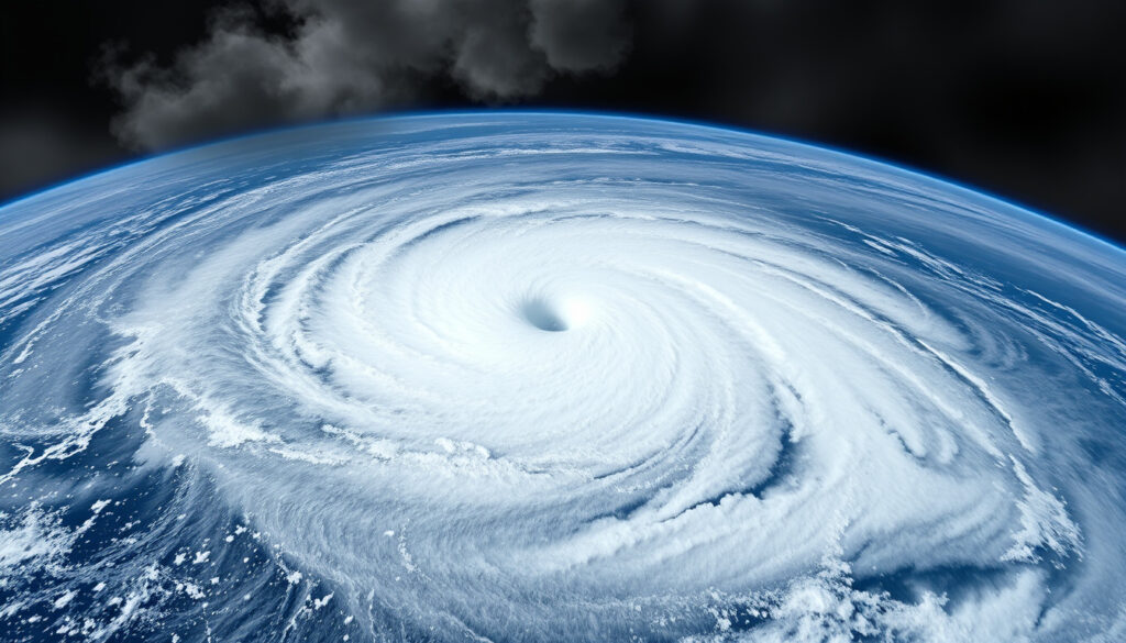
For days, tens of thousands of Queenslanders watched a single number determine their fate. Cyclone Alfred reached Category 4 — the most intense storm to threaten southeast Queensland in recent memory — before weakening, regrouping, and eventually making landfall as a subtropical system in early March 2025. Understanding that swing from Category 4 to Category 1, and what each rating actually means on the ground, matters when your evacuation order depends on it.
Peak Category: 4 (severe) · Highest Winds: 165 km/h · Lowest Pressure: 954 hPa · Status Update: Weakened to Category 1, re-intensified · Affected Areas: Southeast Queensland coast
Quick snapshot
- Peak Category 4 per Bureau of Meteorology
- 165 km/h sustained winds at peak (90 knots, 10-min mean) (Bureau of Meteorology)
- 954 hPa central pressure (Bureau of Meteorology)
- Official damage cost figures from Queensland government
- UTC timestamps for all intermediate intensity changes
- Category 4 peak: 28 February 2025
- Downgrade to Cat 1: 2 March
- Re-intensification to Cat 2: 6 March
- Recovery operations ongoing across SEQ
- Long-term erosion monitoring on Gold Coast
| Attribute | Value | Source |
|---|---|---|
| Peak Category | 4 (severe tropical cyclone) | Bureau of Meteorology |
| Sustained Winds | 165 km/h (BOM 10-min) | Bureau of Meteorology |
| Central Pressure | 954 hPa | Bureau of Meteorology |
| Formation Date | February 2025 | Wikipedia |
| Landfall Area | Southeast Queensland | Bureau of Meteorology |
| 7-Day Max Rainfall | 1,146 mm (Upper Springbrook) | Bureau of Meteorology |
| Brisbane 24h Rainfall | 275.2 mm | Guy Carpenter |
| Properties Without Power | 80,000+ | Wikipedia |
Is Cyclone Alfred a category 2 or 3?
The short answer: Alfred was a Category 4 at its peak. The more complete answer involves a system that spent only one day at its strongest point before beginning to weaken, then surprised forecasters by re-intensifying closer to the coast.
Peak intensity details
Severe Tropical Cyclone Alfred (22U) reached its lifetime peak intensity of Category 4 — 90 knots (165 km/h sustained winds, 10-minute mean) — on the morning of 28 February 2025 while still positioned offshore, according to the Bureau of Meteorology. The Category 4 status held for roughly 18 hours, from 4 am AEST until 10 pm AEST that same day, before the system began interacting with cooler waters and increasing wind shear.
The central pressure bottomed out at 954 hPa during that peak phase. BoM’s official history notes this occurred over waters between 29–30°C, providing ample heat energy for rapid intensification before the storm entered a more hostile environment.
Category fluctuations
By 10 am AEST on 2 March 2025, Alfred had weakened to Category 1 as it tracked southeastward roughly 460 km northeast of Brisbane. The downgrade was confirmed by both the Bureau of Meteorology and post-event analysis from Guy Carpenter. But the weakening was not the end of the story.
Alfred re-intensified to Category 2 at 4 am AEST on 6 March 2025, per BoM records. It then crossed Moreton Island at approximately 23:30 AEST on 7 March 2025 with sustained winds around 75 km/h, before being downgraded to a tropical low by 6:45 AEST on 8 March and making final landfall near Brisbane around 9 pm AEST.
Alfred was never a straightforward Category 2 or 3 storm. It peaked at Category 4, bottomed out at Category 1, and came ashore as a Category 2-equivalent — all within the span of two weeks.
Has Cyclone Alfred been downgraded to a category one?
Yes — twice, technically. The first downgrade occurred on 2 March 2025 when Alfred weakened from its Category 4 peak to Category 1 while positioned east of Rockhampton, roughly 460 km from Brisbane. The second downgrade happened on 8 March 2025, when the system was reclassified as a tropical low as it crossed Bribie Island.
Downgrade timeline
According to the Bureau of Meteorology, Alfred held Category 4 intensity for approximately 18 hours on 28 February before wind shear and cooler sea surface temperatures began eroding the storm’s structure. By 10 am AEST on 2 March, the system had been downgraded to Category 1.
During the period from 3–5 March, Alfred exhibited subtropical characteristics with intensity between 45–55 knots, before being formally reclassified as a tropical Category 1 system at 10 pm AEST on 5 March. The system then re-intensified to Category 2 on 6 March as it approached southeast Queensland.
Re-intensification
The re-intensification surprised some forecasters. After weakening to Category 1 on 2 March, Alfred spent several days in a transitional subtropical phase before reorganizing over warmer waters closer to the coast. At 4 am AEST on 6 March, BoM confirmed the system had climbed back to Category 2, bringing renewed urgency to evacuation orders across the Sunshine Coast and Gold Coast regions.
The back-and-forth between Category 4, Category 1, and Category 2 made it difficult for residents to judge threat levels. Emergency managers had to balance the risk of over-warning (which breeds complacency) against the risk of under-warning before a re-intensifying system.
How bad is a category 2 cyclone in Australia?
Australian cyclone categories are not equivalent to the Saffir-Simpson scale used in the Atlantic. The Bureau of Meteorology defines Category 2 as capable of producing gusts exceeding 125 km/h — winds strong enough to bring down trees, damage unsecured structures, and pose genuine danger to anyone caught outdoors.
Damage potential
Category 2 cyclones can cause significant damage to mobile homes, caravans, and poorly constructed sheds. Roof tiles may be lifted, windows cracked, and outdoor furniture transformed into projectiles. Power outages are common, and minor flooding can accompany the heavy rain that typically accompanies these systems.
For southeast Queensland — a region unaccustomed to direct cyclone hits — a Category 2 landing carried extra weight. Many structures in the coastal strip were built to Queensland’s standard building codes, but older homes and informal additions presented vulnerable points.
Wind and impacts
When Alfred approached as a Category 2 system in early March 2025, wind gusts exceeding 100 km/h were recorded at Brisbane and the Gold Coast, with Byron Bay experiencing gusts up to 120 km/h, according to post-event analysis. The Gold Coast also recorded a 12.3-metre wave — the highest in 38 years — during Alfred’s passage, demonstrating that the damage potential from a Category 2 storm extends well beyond wind.
The combined wind, wave, and rain impacts left over 80,000 properties without power across Queensland and New South Wales during the event.
Where did Cyclone Alfred hit?
Unlike the typical Gulf of Carpentaria track taken by previous Alfred-named storms, the 2025 system made its most significant landfalls on islands off the coast of Brisbane before tracking inland across SEQ.
Landfall location
Alfred crossed Moreton Island at approximately 23:30 AEST on 7 March 2025 with sustained winds around 75 km/h, according to the Bureau of Meteorology’s official timeline. The system then moved across Bribie Island as a subtropical cyclone at approximately 8 pm AEST on 8 March 2025, before being downgraded to a tropical low near Brisbane around 9 pm AEST.
Neither island landfall represented the full fury of the storm at peak intensity — that energy had already dissipated as the system interacted with the coast and cooler waters. But the coastal communities from Caloundra to Coolangatta absorbed sustained tropical storm-force winds and extraordinary rainfall. Travellers planning cruise from Brisbane departures should monitor local conditions during cyclone season.
Path tracked
Formed on 21 February 2025 as the seventh named storm of the 2024-25 Australian region cyclone season, Alfred tracked south-southeastward across the Coral Sea for nearly two weeks before making its sequential island landfalls. The system remained offshore long enough to reach Category 4 intensity over warm Coral Sea waters before the eyewall collapsed and the system began its erratic weakening-reintensification cycle.
Alfred’s path — from Far North Queensland origins to a southeast Queensland landfall — is unusual for Australian cyclones, most of which affect the north and west coasts. The storm spent roughly two weeks over water, giving it time to interact with multiple ocean temperature regimes.
Cyclone Alfred wind speed
The peak wind speed recorded during Alfred’s lifetime was 165 km/h sustained (90 knots, 10-minute mean) — placing the storm firmly in Category 4 territory as defined by the Bureau of Meteorology scale.
Sustained winds
The 90-knot figure represents the highest sustained wind measurement during Alfred’s peak phase on 28 February 2025. This is distinct from wind gusts, which typically run 20–30% higher. BoM’s official history confirms the peak sustained winds held for approximately 18 hours on 28 February.
By comparison, the 2017 Cyclone Alfred — an entirely different storm affecting the Gulf of Carpentaria — peaked at just 50 knots (95 km/h), a Category 1 system per Bureau of Meteorology records. The 1986 Cyclone Alfred reached only 83 km/h at its strongest, also Category 1, and caused no reported damage per BoM’s official history.
Gust records
The Bureau of Meteorology reports wind gusts exceeding 125 km/h in Category 2 conditions, with Category 4 representing gusts above 225 km/h. During Alfred’s approach to southeast Queensland in early March 2025, wind gusts over 100 km/h were recorded at Brisbane and the Gold Coast, with Byron Bay experiencing gusts up to 120 km/h — all consistent with the system’s Category 2 reclassification at that time.
| Metric | Value | Notes |
|---|---|---|
| Peak Sustained Winds | 165 km/h (90 knots) | BoM 10-minute mean, 28 Feb 2025 |
| Peak Gusts | Estimated 225+ km/h | Category 4 threshold |
| Central Pressure | 954 hPa | At peak Category 4 |
| Coastal Gusts (SEQ) | 100–120 km/h | During Category 2 landfall |
| 1986 Alfred Peak | 83 km/h | Category 1, no damage |
| 2017 Alfred Peak | 95 km/h | Category 1, Gulf of Carpentaria |
Timeline of Cyclone Alfred (2025)
Alfred formed in late February and spent nearly two weeks tracking toward southeast Queensland, fluctuating between Category 4 and Category 1 before making landfall.
| Date | Event | Source |
|---|---|---|
| 21–22 February 2025 | Formed as Tropical Cyclone Alfred, Category 1 | Wikipedia |
| 28 February 2025 | Peak Category 4 intensity, 165 km/h sustained winds | Bureau of Meteorology |
| 2 March 2025 | Weakened to Category 1, 460 km northeast of Brisbane | Guy Carpenter / BoM |
| 3–5 March 2025 | Subtropical phase, 45–55 knots intensity | Bureau of Meteorology |
| 5 March 2025 | Reclassified as tropical Category 1 | Bureau of Meteorology |
| 6 March 2025 | Re-intensified to Category 2 | Bureau of Meteorology |
| 7 March 2025 | Landfall Moreton Island, 23:30 AEST | Wikipedia |
| 8 March 2025 | Crossed Bribie Island as subtropical cyclone | Bureau of Meteorology |
| 8 March 2025 | Downgraded to tropical low, 6:45 AEST | Wikipedia |
| 9 March 2025 | Brisbane 24-hour rainfall: 275.2 mm | Guy Carpenter |
| 10 March 2025 | Max 7-day rainfall: 1,146 mm at Upper Springbrook | Bureau of Meteorology |
Alfred’s intensity swings — peaking at Category 4, dropping to Category 1, then climbing back to Category 2 — reflect the storm’s interaction with an ocean environment that was not uniformly conducive to maintenance. A Category 2 approaching a densely populated coastline can still deliver Category 4-level impacts if the storm structure is broad and slow-moving.
Confirmed facts
- Peak Category 4 per BoM official history (verified by multiple sources)
- 90-knot sustained winds on 28 February 2025
- 954 hPa central pressure at peak
- Weakened to Category 1 by 2 March 2025
- Re-intensified to Category 2 on 6 March 2025
- Bribie Island crossing at 8 pm AEST 8 March 2025
- 1,146 mm rainfall at Upper Springbrook (7-day total)
What’s unclear
- Official Queensland government damage cost totals
- Precise UTC timestamps for intermediate transitions
- Detailed satellite analysis of peak intensity eyewall structure
Quotes and perspectives
“Alfred was at its lifetime peak intensity of Category 4 strength (90 knots, 165 km/hr 10-minute mean winds).”
— Bureau of Meteorology, Official Cyclone History
“A Category 2 cyclone might sound low. But Alfred’s bringing sustained tropical storm-force winds, heavy rainfall, and dangerous storm surge to one of the most densely populated coastlines in Australia.”
— ABC News, March 2025 coverage
Summary
Cyclone Alfred peaked at Category 4 with 165 km/h sustained winds on 28 February 2025 — roughly twice the intensity of the two prior storms sharing that name — before weakening, regrouping to Category 2, and crossing the islands off Brisbane as a subtropical system. The wind numbers tell only part of the story. Over 80,000 properties lost power across Queensland and New South Wales, the Gold Coast recorded its highest waves in nearly four decades, and Brisbane experienced its wettest single day since January 1974.
For Queensland coastal residents, the lesson cuts both ways: a storm that weakens offshore can still deliver catastrophic inland flooding, and a Category 2 landing on an unseasoned coastline can prove as destructive as a Category 4 hit on a hurricane-hardened region. Sports fans attending events such as Brisbane Roar FC games should remain aware of residual impacts during post-cyclone recovery periods.
Frequently asked questions
Has there been a category 5 cyclone in Australia?
Yes. Australia has recorded multiple Category 5 cyclones, including Cyclone Yasi (2011, which hit Queensland) and Cyclone Marcia (2015, also Queensland). Category 5 represents wind gusts exceeding 280 km/h. Alfred never reached Category 5.
How bad will Cyclone Alfred be?
At peak Category 4, Alfred was capable of catastrophic damage. By the time of its landfalls near Brisbane as a Category 2/subtropical system, it had weakened substantially, but still caused extensive power outages, beach erosion, and flooding across SEQ.
Has Queensland had a category 5 cyclone?
Yes. Queensland has been hit by several Category 5 cyclones, most notably Cyclone Yasi in 2011, which devastated communities around Tully and Mission Beach with wind gusts exceeding 285 km/h.
Is a category 3 cyclone big?
Category 3 cyclones produce wind gusts between 165 and 224 km/h, capable of significant damage including roof loss, destroyed caravans, and downed trees. Alfred was stronger than Category 3 at its peak, though its final landfall was weaker.
Has Australia ever had a category 4 cyclone?
Yes. Category 4 cyclones are not uncommon in Australia. Alfred (2025) was one, and notable Category 4 storms include Cyclone Ita (2014) and Cyclone Trevor (2019). Category 4 represents wind gusts between 225 and 279 km/h.
What caused Cyclone Alfred?
Alfred formed over warm Coral Sea waters in late February 2025, when sea surface temperatures in the region ranged between 29–30°C — well above the 26°C threshold needed to sustain tropical cyclone development. Favorable upper-level conditions allowed the system to reach Category 4 intensity before wind shear and cooler waters weakened it.
What was Cyclone Alfred’s wind speed?
Peak sustained winds reached 165 km/h (90 knots, 10-minute mean), classified as Category 4 by the Bureau of Meteorology. Coastal gusts during the Category 2 landfall phase reached 100–120 km/h at various locations between Brisbane and Byron Bay.
More related posts
 Guy Pearce: Nationality, Family, Career & Kevin Spacey
 482 Visa Processing Time 2026: Guide, Refusal & PR Pathway
 System of a Down – Members, History, Albums and 2025 Updates
 Creamy Pasta Recipes: Foolproof Silky Sauce Techniques
 Andrew Place Clinic – Bundoora & Mill Park Family GP Since 1971
 Jemima Goldsmith: Biography, Marriage, and Life Now
 Stephen Graham: Dyslexia Diagnosis, Family, New Drama
 Disney Plus Subscription – Plans Pricing and Bundles Guide
